gtag('consent', 'update', {'ad_user_data': 'granted','ad_personalization': 'granted','ad_storage': 'granted','analytics_storage': 'granted' });
A A A
en
NL EN DE
Fotolux_Hanzestad_deel_1_19-09-2025_LR_07
Fotolux_Hanzestad_deel_1_19-09-2025_LR_05
Bommelse Brocante
koopzondag-1771335579

Route Marycken

4 kilometers 1.5 hours
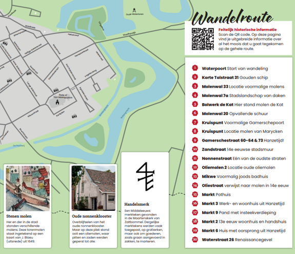
Walk along with Marycken Hanrick Michielsen, the miller's wife of Zaltbommel. In 1584 she requested permission to build a new mill near the Gamerschepoort, after her old mill had been lost due to war violence. Walk past medieval mill ramparts, the Gamerschepoort and monumental Hanseatic buildings.

Directions

1
Watergate — Start of walk Waterpoort, Zaltbommel
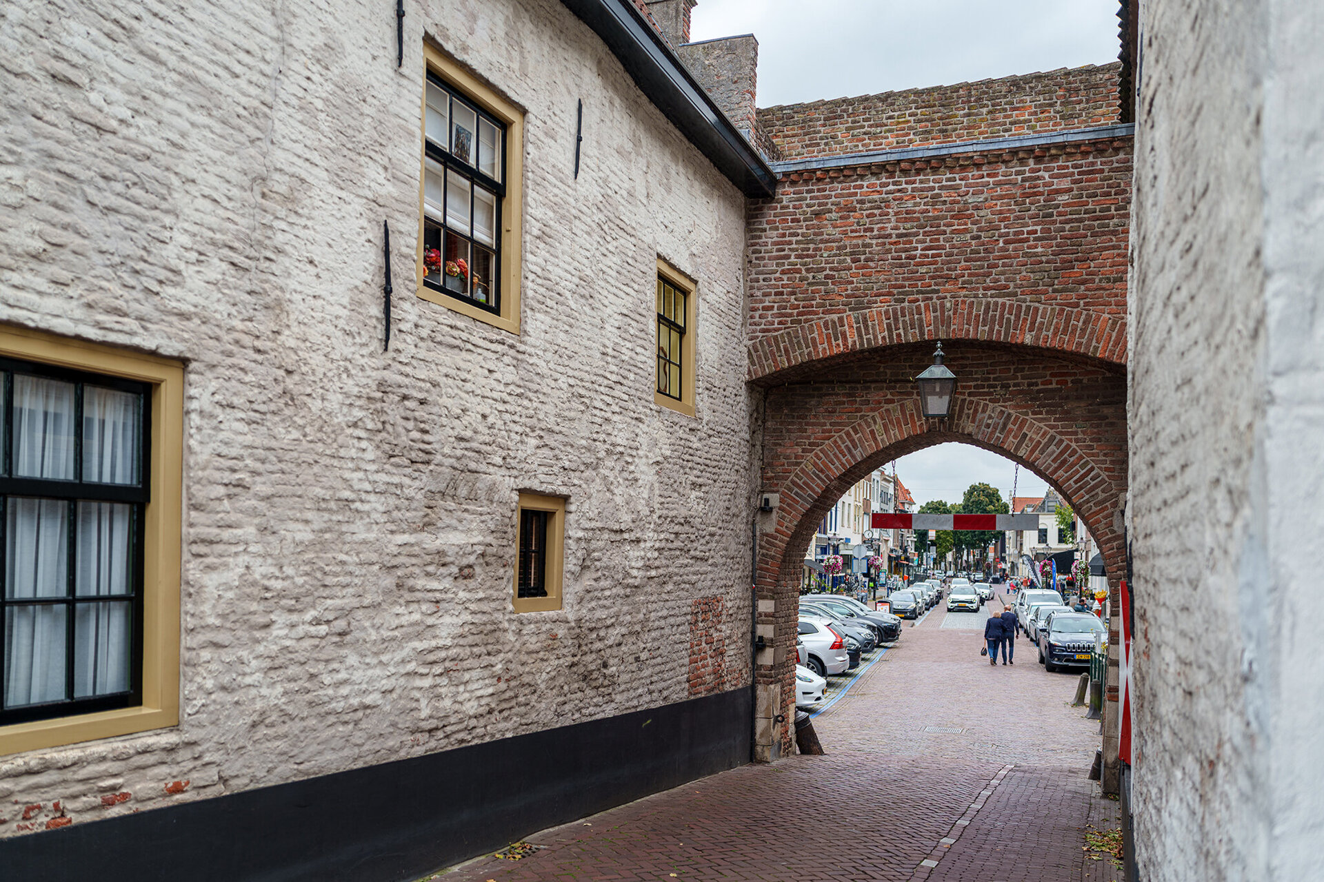
In the first half of the fourteenth century, a city defence was constructed in Zaltbommel, consisting of a city wall and a moat. Bommel formerly had five city gates: the Gamerschepoort, the Bosschepoort, the Oenselsepoort, the Steigerpoort and the Waterpoort, which is the only one that has survived. In 1942-1943 the Waterpoort was restored and given its current appearance (without a plaster layer). The reason why the gate was preserved is not easy to explain, but could be related to the fact that houses had been built against the inner side of the gate, which were in use.

From the waterside we walk through the gate. The Waterstraat lies ahead of us, but we immediately turn right along the terrace into the Korte Tolstraat.
2
Korte Tolstraat 31 — Golden ship Korte Tolstraat 31, Zaltbommel
Look up for a moment at the second house on the right side. On the roof, a golden ship is mounted. It is reminiscent of a cog ship, the transport vessel that was widely used by the Hanseatic League in the fourteenth and fifteenth centuries for transporting goods. Perhaps seeds, pits, and buckwheat were also brought in? Who can say.

The Korte Tolstraat continues into the Tolstraat. Turn right, walk out of the Tolstraat and turn left onto the Molenwal.
3
Molenwal 33 — Location of former mills Molenwal 33, Zaltbommel
Because of wind exposure, windmills were built in open fields or on higher ground. Sometimes a mound of earth was specially raised for the mill (a belt or mound mill). In Bommel, mills stood on the higher-lying city defence wall. In many cities, a street name can still be found that refers to the mill(s) that stood there. The same applies to Zaltbommel: we walk along the Molenwal.
4
Molenwal 7a — City landscape of rooftops Molenwal 7a, Zaltbommel
Past house number 7a, a beautiful urban landscape opens up on the left. The roof structures you see here date from the Hanseatic period. A well-preserved sight.

Continue along the Molenwal, straight ahead. The city harbour is on the right.
5
Bolwerk de Kat — Here stood mill de Kat Bolwerk de Kat, Zaltbommel
To the right lies the bastion de Kat, which was constructed after the Hanseatic period in the seventeenth century. Windmills stood on this bastion, which is why it was also called Molenbolwerk (Mill Bastion); a mill that stood there was called 'De Kat' after which the bastion was named. Maryckens mill stood further along.
6
Molenwal 20 — Striking barn Molenwal 20, Zaltbommel
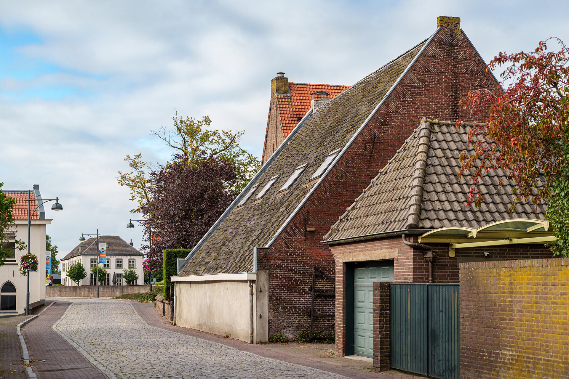
We see on the right a striking barn, Molenwal 20, with four skylights, a steel railing and the ridge of the roof parallel to the street. During the Hanseatic period, a horse mill stood here. The building that stands there now dates from the seventeenth century. The life of a horse that worked in a horse mill was dull and monotonous. The animal walked lonely circles to set the mill wheel in motion.

We turn left into the picturesque Molengang. This name too is a reference to the mills that once stood in this neighbourhood.
7
Crossroads — Former Gamerschepoort Gamerschestraat, Zaltbommel
Then turn right into the Gamerschestraat.
At the end we reach the intersection of the Gamerschestraat, which continues into the Steenweg, Singelwal and Molenwal. The Gamerschepoort once stood at this intersection.
8
Crossroads — Location of Marycken's mill Gamerschestraat, Zaltbommel
Marycken asked to be allowed to build her mill beyond this spot, where the Gamerschepoort defined the cityscape until shortly before 1830. In Marycken's time, the gate was an important part of the city's defences, with a front gate and main gate. A gate building can be considered a large architectural complex in the city wall.
The Gamerschepoort had a curved passage, meaning that the openings of the gate were not aligned with each other. Cannonballs that accidentally came through the gate were deflected by the curved passage. That had been thought through. The gate had become an obstacle due to the increase in traffic, but also because of its dilapidated state, the city decided in 1829 to demolish and tear it down.

It is no longer possible to determine whether Marycken's mill stood to the left or right of the road. The Stadshaven, as well as the car park, did not yet exist in the Hanseatic period. Here was an open plain, a wide field with windmills.

We go back along Steenweg and, as seen from Steenweg, continue straight ahead into Gamerschestraat.
9
Gamerschestraat 60-64 & 73 — Hanseatic times! Gamerschestraat 60, Zaltbommel
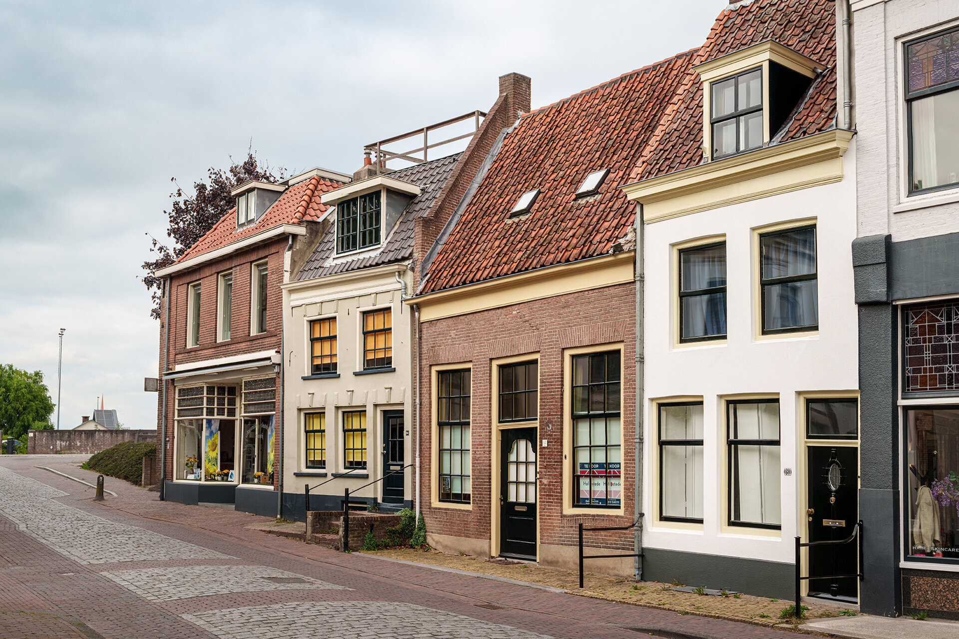
Gamerschestraat 64-62 is a row of houses that may not look like it dates from the Hanseatic period, but the roof runs parallel to the street (building line), a typical architectural feature from the Hanseatic period. This way of building required less building material and provided more (storage) space.

Gamerschestraat 73 is a corner building with an upper floor and a hip roof. This building was also built during the Hanseatic period, and dates from the fifteenth century. It is beautiful with a lovely facade, which incidentally does not date from the Hanseatic period. The side is interesting for our search for Hanseatic traces. Here it is clearly visible that the building is much older than the front facade suggests.

Before number 73 we turn right into the Zandstraat
10
Zandstraat — 14th century city wall Zandstraat, Zaltbommel
In the Zandstraat we can see on the right side a remnant of the fourteenth-century city wall as well as of the moat embankment. It appears that beyond Zandstraat 2 a section of old city wall is still standing (or perhaps that the Medieval stones have been reused). Further along we can see the remains of the old Medieval city moat.

We continue walking along the site of the old fourteenth-century city wall.
11
Nonnenstraat — One of the oldest streets Nonnenstraat, Zaltbommel
The Zandstraat bends to the left and becomes Nonnenstraat, which was already paved in the sixteenth century. The street name refers to the convent that stood on this street. It is one of the oldest streets in Zaltbommel. In the bend, the Kleine Stenen mill stood on a wall tower.

On the right is the alley Oliemolen. We can walk in there for a moment.
12
Oliemolen 2 — Site of the old oil mill Oliemolen 2, Zaltbommel
Oliemolen 2 marks the site of the remains of an old nunnery, but an old oil mill once stood here as well. Oil was a sought-after commodity during the Hanseatic era; it was pressed from kernels and seeds. In 1378, Henricus Moliaert sold a plot of land to Arnoldus Hoel, and an oil mill was subsequently built there. The name of the alley refers to this mill. Later, in the fifteenth century, a mill owned by Gerard Trip—a member of a wealthy merchant family—would be erected on this site. You can also take a walk that explores the life of Jan Trip. For now, however, we continue with the story of Marycken.

Walk back and turn right to continue along Nonnenstraat. A little further on, turn left onto Kloosterstraat. There are beautiful buildings on the left-hand side (at numbers 24 and 26). Continue walking and turn right onto Minnebroederstraat.
13
Mikveh — Former Jewish bathhouse Kloosterstraat, Zaltbommel
The Jewish synagogue (number 4) used to stand on the right-hand corner of Kloosterstraat and Minnebroederstraat. Next to it, on Kloosterstraat (just before number 2c), was the Jewish bathhouse, or *mikveh*. The *mikveh* was always located near or next to the synagogue. Although the building itself appears modern, the site holds a rich history—that of Jewish life in Bommel. *Stolpersteine* (stumbling stones) have been set into the pavement to remind us of the millions of Dutch Jews who were mistreated, discriminated against, and murdered during the Second World War. Little remains of Jewish life in Zaltbommel today.

In Marycken’s time, neither a *mikveh* nor a synagogue stood here; the Jewish community rented space in private homes. Jewish people had settled in Zaltbommel as early as the Hanseatic period. They enjoyed a relatively high degree of freedom here, were left undisturbed, and could practice their religion without significant hindrance. While Jews were barred from guild membership, they were permitted to lend money at interest—unlike Christians—which proved advantageous for the merchants of Bommel. Both during the Hanseatic era and afterwards, Jewish traders frequently acted as financiers for commercial ventures.

We continue walking towards Oliestraat. Beautiful old white-plastered buildings stand on the corner of Minnebroederstraat and Oliestraat. It is possible that a farmhouse stood here during the Hanseatic period as well.

We turn left onto Oliestraat.
14
Oliestraat — refers to a mill in the 14th century Oliestraat, Zaltbommel
The street name refers to the aforementioned Posthouwer oil mill, which stood there as early as the fourteenth century. The owner was likely named Posthouwer. In an old document from 1515, this street is listed as Molenstraat.

At the end of Oliestraat, we turn right onto the Markt.
15
Market — Pothuis Markt, Zaltbommel
At the intersection of the Markt—with Waterstraat to the left—we see many buildings bearing traces of the Hanseatic era.

First, on the right at the corner of the Markt and Boschstraat, we see a *pothuis* (a small lean-to extension) attached to the side wall. We see another one on the building diagonally opposite, at the corner of Gasthuisstraat and Waterstraat. These are remarkable remnants of the Hanseatic period that remain in use today.

In the Middle Ages, there were far more of these *pothuizen* than there are now. A *pothuis* is a small structure built over a cellar that served as a workspace without blocking light from the main house. As traffic increased, these curious structures became a hindrance, leading to the demolition of many of them.

The building at Markt 1—on the right-hand corner as you approach from the Markt—still features a *hangkamer* (suspended room) dating back to the Hanseatic era. This type of construction is found in many houses in Zaltbommel. It consists of a mezzanine level situated above the fireplace, originally set slightly back from the front façade. This created an additional room that did not require separate heating, while light entered through the windows. It was an efficient way to create more space while ensuring sufficient natural light.
16
Markt 3 — Hanseatic-era house and workshop Markt 3, Zaltbommel
The building at Markt 3 features a striking pillar in its façade, positioned between the upper-level windows. During the Hanseatic era, it served as both a home and a place of work. The façade is truly beautiful, and its origins in the Hanseatic period are clearly evident. The distinctive pillar situated between the upper windows is a hallmark of the Renaissance—the architectural style favored here at the close of the Middle Ages. Was the pillar created by firing the bricks with the motif already in place, or by carving the design after firing? That remains unknown. Marycken must have seen this façade whenever she walked through the city.
17
Markt 9 — Building with a mezzanine Markt 9, Zaltbommel
The building at Markt 9 also has a mezzanine, just like Markt 1 and 6.
18
Markt 2 — 13th-century residential and commercial building Markt 2, Zaltbommel
The building at Markt 2, on the corner of Waterstraat, is magnificent. It was originally a private residence in the thirteenth century. It is a unique structure featuring many details from the Hanseatic era, such as a *pothuis* (a small lean-to extension), a stepped gable, and shutters. It is one of Bommel’s earliest stone buildings and the best-preserved among them. Later, during the Hanseatic period, it housed a trading business. The shutters on the Waterstraat side, when opened, served as sunshades; the shutters beneath the windows could also be folded up to function as a shop counter. It is one of the oldest stone buildings in Bommel.
19
Markt 6 — House dating back to the Hanseatic era Markt 6, Zaltbommel
The building in the same row, at Markt 6, features a mezzanine. The gable stone bears the inscription ‘De Blauwe Fles’ (The Blue Bottle). Although the date 1644 appears on the façade, the building is much older, dating back to the Hanseatic era. During that time, it served as both a residence and a place of work—just as it does today.

Walk into Waterstraat (with the Waterpoort visible in the distance).
20
Waterstraat 26 — Renaissance façade Waterstraat 26, Zaltbommel
The building at Waterstraat 26 (on the right) stands out because of its color. It is a remarkable structure. It is frequently cited as a significant example of Renaissance architecture in the Low Countries—a style that gained popularity towards the end of the Middle Ages. While the roof structure dates back to 1540, the size of the bricks suggests that some of the walls are considerably older, pointing to a date in the first half of the fifteenth century. Archaeologists discovered a deep wharf-like structure in the cellar. The theory is that dignitaries could reach the building by boat from the Waal River—though it remains just that: a theory.

Marycken saw this façade too, although it may have looked slightly different back then. The natural stone carvings and architectural elements date from the sixteenth century; researchers wonder if the ornaments might have originated from the town palace of Johan van Rossum (Maarten’s brother), who owned the house at Kerkplein 16. Over the centuries, the building has undergone numerous alterations, renovations, and modifications to become what it is today.

The Water Gate is already in sight. Marycken waves goodbye here. She walks back to the market square to buy a jug of white Mosel wine. It is a beautiful day.
Wandelroute Marycken